New gamma-ray calorimeter have been develop ed for the MEGA Compton camera.They consist of arrays of small CsI(Tl) scintillator bars read out by Silicon PIN- diodes and low noise, self triggering frontend electronics. The length of the bars (the thickness of the calorimeter) can b e varied for different applications to fit the stopping power needed and the light loss tolerable. In this paper we present calibration results from 2cm long bars with diodes on one side, and 8cm long bars with diodes on two opposite sides.
Doublesided readout gives 3-D information of interactions which will b e used to overcome the limited position resolution in Anger-cameras at high energies. Simpler detection devices like Anger-cameras might finally resolve only the center of gravity.
As events from gamma rays with energies of MeV do extend over several cm, it is a prerequisite for an imaging device to resolve the interaction structure in detail.
Combining CsI(Tl) scintillators, Silicon PIN-photo dio des and frontend electronics inside the housing results in a cheap rugged design. While the development in our institute is mainly done for the Compton camera prototyp e, many other applications are conceivable.
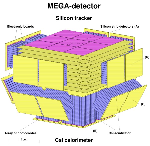
CsI calorimeter with 3-D position resolution
 ,
, 